Oh, the things one does when one is at a loose end.
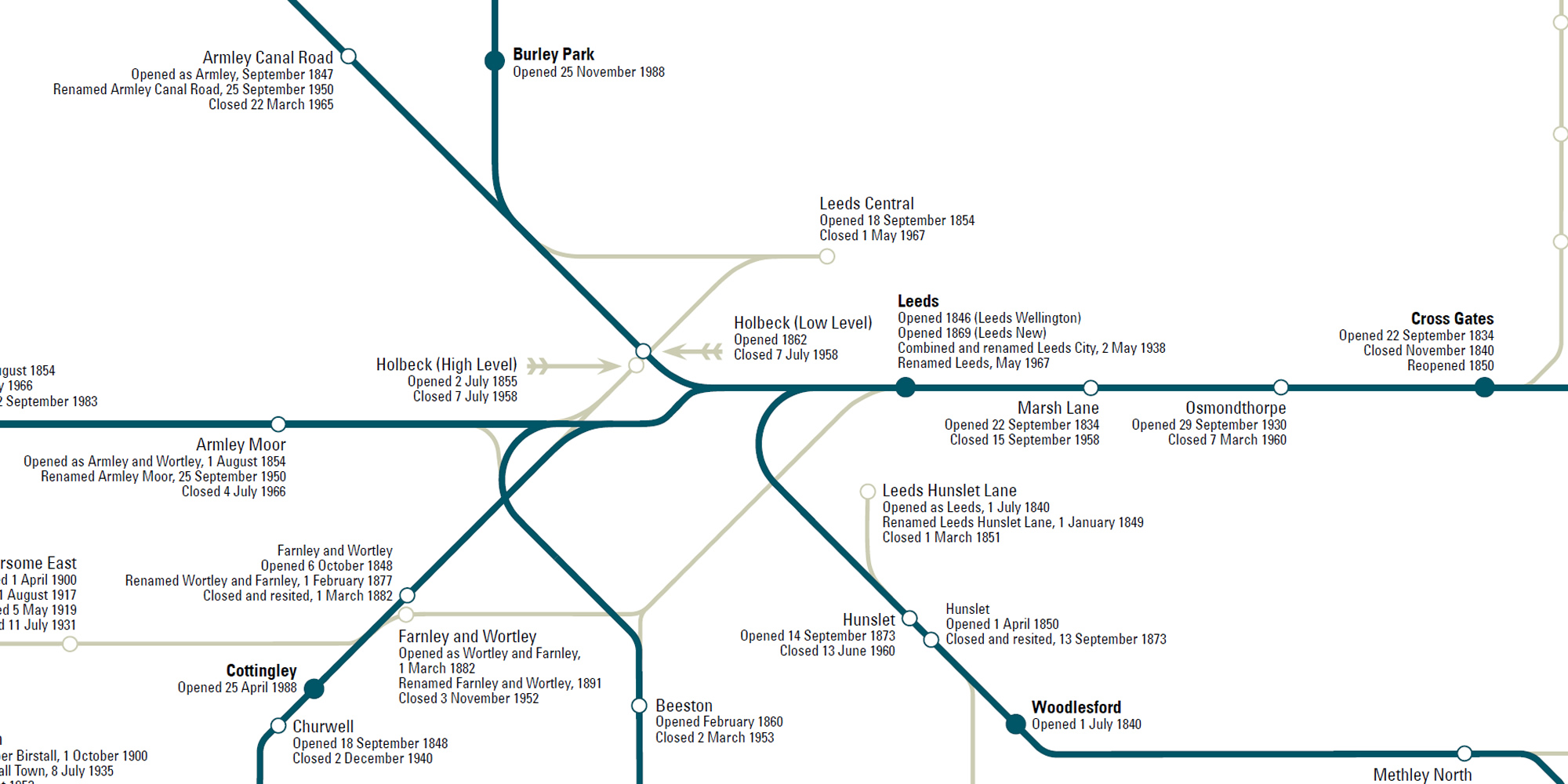
Having finished the West Riding MetroTrain map the other map I thought about was the closed stations in Yorkshire research I did back in 2017. Sadly that map needs revisiting; the pins don’t work properly and I’ve made a few omissions, only some of which I’ve found and added to the file.
The problem with the Google map is that it’s just (just!) a set of pins; there’s no relationship between the pins on, for example, closed lines.
So I did this instead!
It uses the data from the Google map, updated and corrected as I went along. And with a great many suggestions and amends from the denizens of Rail UK Forums, including making the station names a bit larger. They’re 20% larger than the rest of the label (6pt instead of 5pt).
First Edition 1.0 came out on 3 May (my mum’s birthday); 1.1 came out on 5 May (parents wedding anniversary). Then I discovered a bit of a snafu around Laisterdyke, so I added in the light railways I’d originally excluded, did all of the other corrections and bumped the edition up to 2 in time for my brother’s birthday.
There are a few other issues to sort, such as the file size getting so large it doesn’t display properly in my iPad. Can’t tell if that’s a problem with Inkscape or InDesign, but I have had to drop the text quality quite a bit. Mind you, we’re talking around 770 station dots and labels here on a map that is B0, reduced to B1 for printing purposes.
Bored now. What’s next?