I bought a new map!
More accurately I bought an old map, on eBay. It’s a “Geographia” Plan of Leeds, one of those aimed at car drivers so the map is cut up and pasted onto some sort of semi-cloth backing, all the easier to fold it. It comes with that lovely old document smell too. Eventually it will be framed and hung… but not just yet. No wall space, for one thing!
The first problem was working out how old the map was. Is. It doesn’t have a date on it anywhere. Fortunately, we know someone who made a map of the closed rail stations in Yorkshire. Holbeck is still open, Beeston has closed, so we’re looking at around 1955.
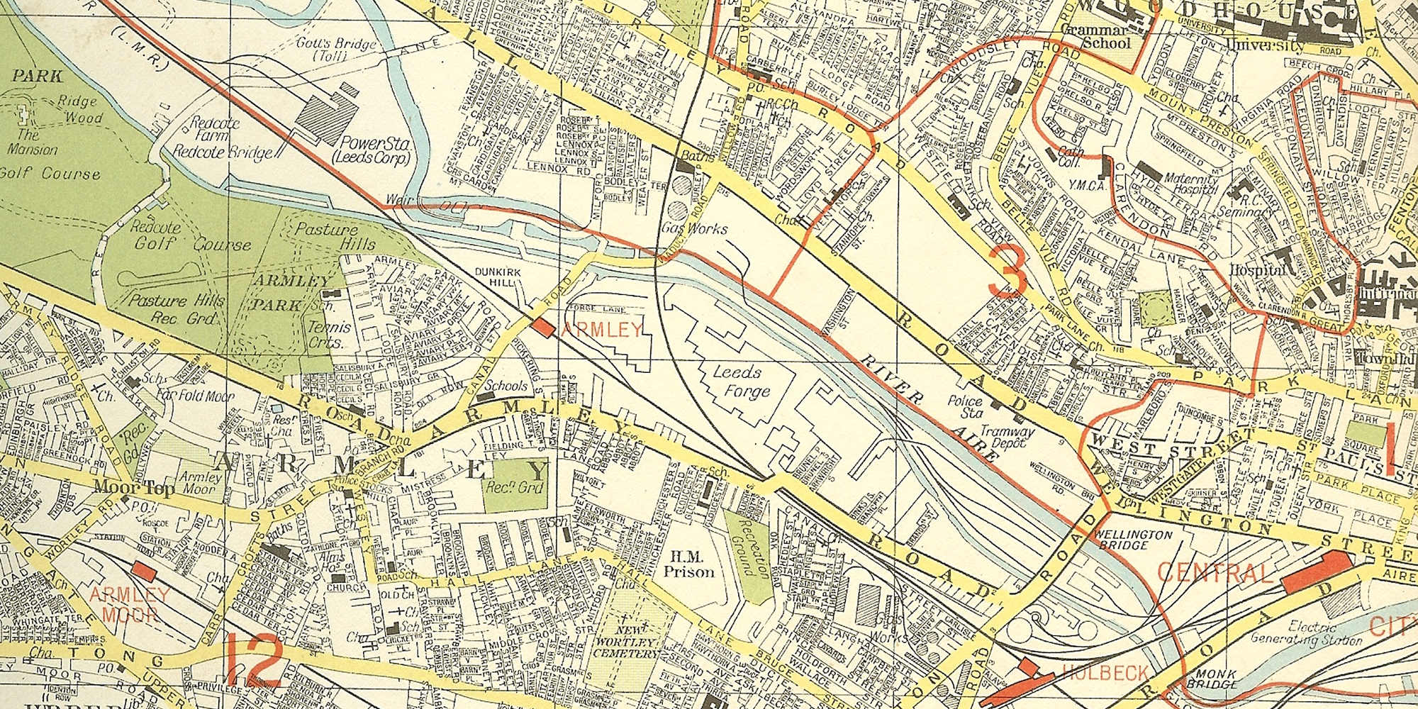
Among the many marvels on the map is that, whereas modern maps usually mark the A roads in a different colour (usually yellow), the colouring here is used to denote municipal tram and bus routes – and showing some gaps on roads where I’d assumed buses had always travelled. As well as roads buses no longer travel along.
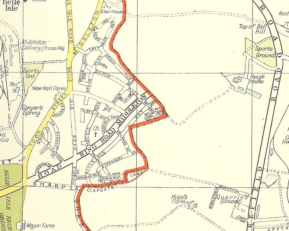
In the north it turns out that most of what is now Leeds 16 was originally part of Leeds 6. And then there’s the Outer Ring Road at Middleton, which suddenly stops at the city boundary. It still does, even though there’s now housing outside the former boundary and that there’s actually a new Ring Road carriageway running alongside it before heading north (the Leeds Outer Ring Road isn’t a complete circle, if you didn’t already know).
All change
Leeds is fortunate that it has an extensive, publicly-available photographic resource called Leodis. It’s a great help in tracking the changes to the urban landscape since the map was produced.
Within five years work had started on the extension of Westgate between Wellington Road, Wellington Street and Park Lane. Ten years after that, Westgate was mostly obliterated by the arrival of the Leeds Inner Ring Road; as was Fenton Street, a much longer, terraced street than the one on which the pub still stands. The Merrion Centre was built; Woodhouse Lane, which was four lanes wide in parts, was closed off to create St John’s Centre and Dortmund Square. Yes, Leeds closed a major traffic thoroughfare… which I’m sure many of us wish was open now, given the state of Albion Street around the corner.
Pedestrians were to be catered for with a footbridge. It started on Infirmary Street, crossed Park Row and paralleled Bond Street via the shopping centre as far as the rear of The Peel (a pub). It was supposed to continue onwards across the city centre, but never did. A very small part of it remains as what looks like a roof terrace on one of the Infirmary Street/Bond Street offices.
But worse was to come: the motorways.
Roads to nowhere
The Inner Ring Road was planned as a motorway-style distributor road for traffic once it hit the local network. First it had to arrive at the city gates.
The M1 ended at junction 44; the rest, originally, was called the Leeds South East Urban Motorway before being renumbered M1. It mostly followed a now-disused railway line but still cut through several back-to-back housing estates. The Leeds South West Urban Motorway left the M62 at junction 27, again using disused railway and taking over the route of Elland Road between the football ground and the southern edge of the city centre. The two motorways met at Meadow Road, a misnomer now if ever there was one.
There should have been a third motorway, which would have connected these two with Leeds north-east, but common sense prevailed, the M1 was eventually given more route miles east of Leeds to connect with the A1 and the two urban motorways were connected together as the M621.
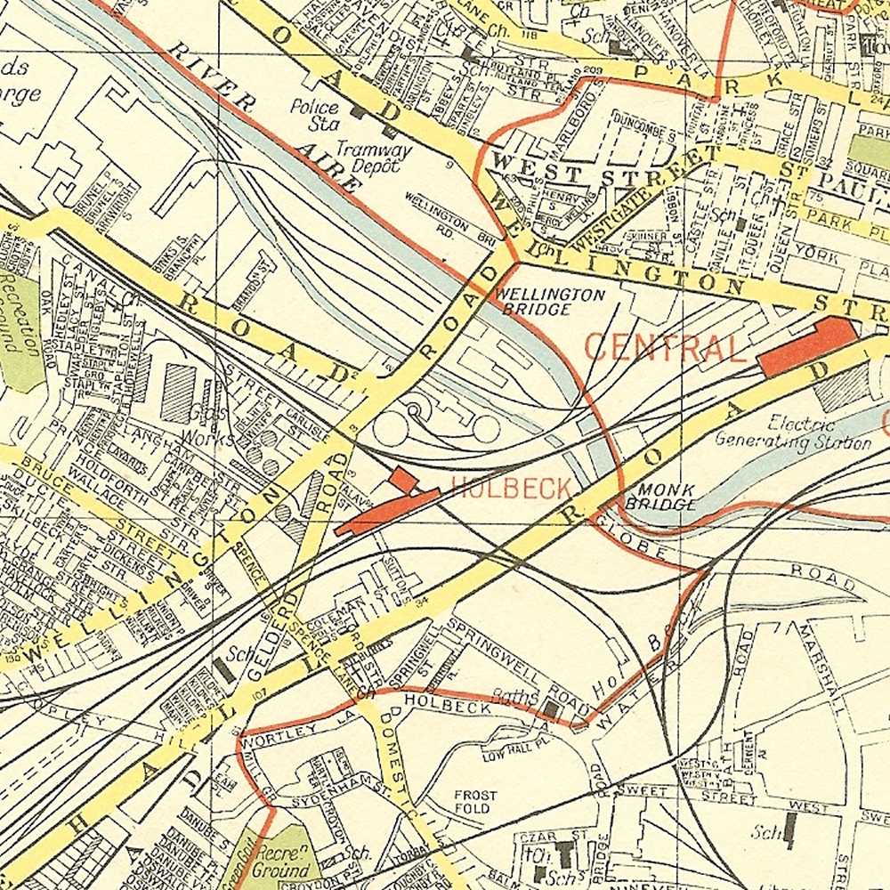
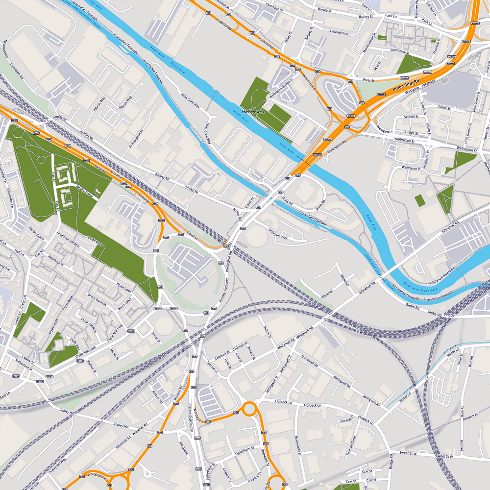
Both ends of the now-M621 also got ‘distributor’ roads, which paralleled the motorways in Holbeck (Ingram Road) and Hunslet (Hunslet Road), mostly passing through industrial areas. The Holbeck route dumped its traffic on a remodelled junction for Wellington Road, Whitehall Road, Gelderd Road and Canal Road. The two images below give a flavour of the before and after. So now you know where the Armley Gyratory came from.
If you start at the M62/M621 junction at Gildersome you can drive into Leeds and out again, skirting the southern fringe before joining the M1; then turn off onto the M62, and arrive back where you started. If they ever created a free-flowing M62 westbound-to-M621 north-bound junction it would be a new circle of hell.
To the future?
It’s not unreasonable to say that the housing stock demolished for these road schemes was not the best; but removing it to be replaced by roads, well that’s a different story. Look at some of the comments on Leodis and you’ll see that people remain loyal to the communities they once lived in, despite the privations.
Connecting Leeds will, eventually, improve some of the traffic flows around the city centre. Whether Bishopsgate Street will ever really be closed to all traffic… I doubt it. Not without a new outer-inner route or two to take the existing non-bus traffic away, and there are no obvious contenders to be upgraded (Water Lane & Globe Road? Unlikely).
New Park & Ride sites are helping at peak times, but we still have several car parks in the centre of the city. Junctions are being remodelled. Armley Gyratory is slated to step forward into the past, with new lanes and cut-throughs that resemble the original routes of Gelderd Road and Wellington Road.
But the M621 will still foul up in the morning and evening peaks, throwing out lots of CO2. I like the proposal to close off the one-direction junction 2A though; it’s not a great junction to come off westbound, and no sooner have you joined eastbound then you’re at junction 3. There are better ways to get to that part of town. And we’ll still have the Inner Ring Road and the Distributors to contend with.
We may never be the ‘motorway city’ once envisioned, but neither can we go back. The genie, once out of the bottle, is mighty difficult to squeeze back inside.